Getting there
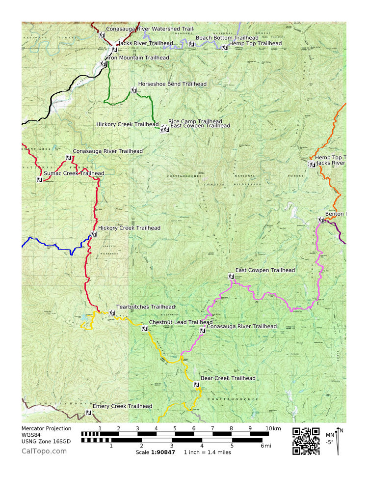
Most of the wilderness lies in Fannin County, but most of the roads into it climb out of northern Murray County. Three approaches carry the names of Murray County post office communities. From south to north they are Eton, Crandall, and Cisco.
Eton and FS 18
The southern approach, and the road to the Conasauga side trailheads: Tearbritches, Chestnut Lead, Betty Gap (the upper trailhead of the Conasauga River Trail), and East Cowpen at Three Forks. It also reaches Emery Creek and the upper Bear Creek trailhead. From Ellijay the faster way to these trailheads is Highway 52 west, right on Conasauga Road to FS 68, then right and up the mountain.
Crandall and FS 630
The central approach. It reaches the West section trailhead of Hickory Creek Trail, the easiest way to the Conasauga River from a road. For Lake Conasauga, take the sharp right at the FS 630 and FS 17 intersection, climb the steep, loose gravel grade on FS 17 for 3.3 miles to a T intersection, and turn right. The lake is under half a mile on.
Cisco and FS 16
The northern approach, and the road to most of the Jacks River trailheads, the Alaculsy Valley, and Cottonwood Patch Campground.
Gravel time
Every trailhead sits at the end of dirt and gravel. Plan on about 15 miles an hour, which puts a trailhead like Beech Bottom about an hour from pavement. A small car can make it if you drive slower. The roads are wide enough for two vehicles to pass.
Winter closures
Each winter the Forest Service gates FS 17 above FS 630 and FS 68 below Potatopatch Mountain. The Lake Conasauga road closes December 29 until March 1. Expect the Chestnut Lead, Tearbritches, Betty Gap, and Three Forks trailheads to be unreachable by car from about the first of the year into early March.
Before you go
Check the Chattahoochee-Oconee National Forest alerts page for road status. The Conasauga Ranger District is at 3941 Highway 76, Chatsworth, GA 30705, (706) 695-6736, and sells the Forest Service map of the Cohutta and Big Frog Wilderness, which shows trails, topography, parking, and access roads. Cell service is unreliable in these mountains, so leave a trip plan with someone expecting you back.