Jacks River Falls
The falls most people mean when they talk about the Cohuttas.
At a glance
- Location
- Jacks River, north end of the Cohutta Wilderness
- Easiest approach
- Beech Bottom Trail, 10 miles round trip, one creek crossing
- Camping
- Day use only, April 1 through October 31
- Fires and alcohol
- Banned year round in the falls area
- Permits
- None currently required
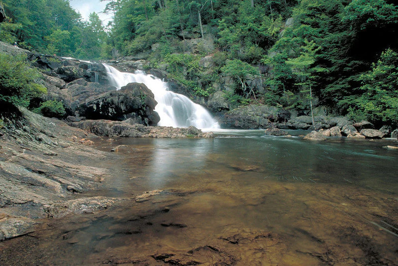
Jacks River Falls is the reason most people first walk into the Cohutta Wilderness. The river pours over a run of dark ledges into a wide pool below steep gorge walls, and no road comes anywhere near it. Every approach is a walk of several miles, and most of them put you in the water at some point.
Beech Bottom is the easy way in, with one creek crossing. The Jacks River Trail from Dally Gap reaches the falls at the end of twenty crossings, and it is the walk people tell stories about. Pick by season and by how wet you are willing to get.
Ways in
- Listed distance
- 10 mi round trip
- Crossings
- 1 crossing
- Difficulty
- Moderate
The standard route. An old roadbed with an easy grade, one crossing of Beech Bottom Creek, then a short walk upstream on the Jacks River Trail to the falls.
- Listed distance
- 8.5 mi one way
- Crossings
- 20 crossings
- Difficulty
- Strenuous
The upper river from Dally Gap, twenty crossings on the way down to the falls. Summer and early fall only.
- Listed distance
- 7 mi round trip
- Crossings
- 9 crossings
- Difficulty
- Moderate
Three and a half miles to the Jacks River Trail, crossing Rice Camp Branch nine times, then a little over a mile upstream to the falls, with a ford of the Jacks along the way.
- Listed distance
- 3.5 mi one way
- Crossings
- No crossings recorded
- Difficulty
- Moderate to Strenuous
From FS 51, about 2.6 miles on East Cowpen to the Hickory Ridge junction, 3.5 miles down the ridge, then six tenths of a mile downstream to the falls.
Closed
The Forest Service closed this trail and Rough Ridge in July 2025 for public safety, after Hurricane Helene added blowdowns and dense regrowth to damage left by the 2016 drought and wildfires. The closure order ran through July 30, 2026 unless extended, and more recent Forest Service alerts list only Rough Ridge as closed. Confirm current status with the Conasauga Ranger District, (706) 695-6736, before you go.
- Listed distance
- 6 mi round trip
- Crossings
- 2 small stream crossings
- Difficulty
- Moderate
Three miles over Ken Mountain, past the Horseshoe Bend Overlook, then down to the Jacks River Trail. The falls are upstream from the junction.
- Listed distance
- 8.3 mi one way
- Crossings
- 22 crossings
- Difficulty
- Strenuous
The long, wet way up from the Alaculsy Valley, twenty two crossings through the lower gorge.
At the falls
In summer the pool below the falls is a swimming hole, and on warm weekends it fills. Come on a Tuesday in October and you may have it to yourself. The trout here are wild rainbow and brown. Nothing in this river has been stocked since the Cohutta became a wilderness in 1975.
The railroad under your feet
Between 1915 and 1935 the Conasauga River Lumber Company cut about seventy percent of what is now the wilderness. Logging reached the Jacks River in 1929. A railroad ran up the river to a logging camp at what is now Jacks River Falls and Beech Bottom, and much of the Jacks River Trail follows its bed. The rails came out in 1937. Crossties and spikes still turn up along the river. Cable does too.
Camping and rules
From April 1 through October 31 the Beech Bottom and Jacks River Falls area is day use only. From November 1 through March 31, camping is allowed at designated sites only. Campfires and alcohol are banned year round, and a map of the closure area is posted at the trailheads. Confirm the current order with the Conasauga Ranger District, (706) 695-6736.
Reading the water
Most approaches put you in the river. A crossing that sits knee deep in August can take your feet out from under you after rain, and these watersheds rise fast. If the water is off color or running hard, wait or turn back.
Loops
- Rice Camp and Horseshoe Bend
12 mile loop
- East Cowpen, Hickory Ridge, and Rice Camp
12.1 mile loop
Hickory Ridge was closed by Forest Service order with Rough Ridge. Confirm it has reopened before planning this loop.
Questions
What is the easiest hike to Jacks River Falls?
Beech Bottom Trail. It is about 10 miles round trip on an easy grade with one creek crossing.
Can you camp at Jacks River Falls?
Not from April 1 through October 31, when the area is day use only. From November 1 through March 31, camping is allowed at designated sites only. Campfires and alcohol are banned year round.
How many river crossings are on the way to Jacks River Falls?
It depends on the route. Beech Bottom has one creek crossing. The Jacks River Trail has twenty from Dally Gap and twenty two from the Alaculsy Valley.
Do you need a permit to hike to Jacks River Falls?
No permit or fee is currently required.
Can you swim at Jacks River Falls?
Yes. The pool below the falls is a popular swimming hole in summer. Stay out when the river is high or off color.
Related
Stay near the trailheads
Sherpa Camp — a cabin at the edge of the wilderness.
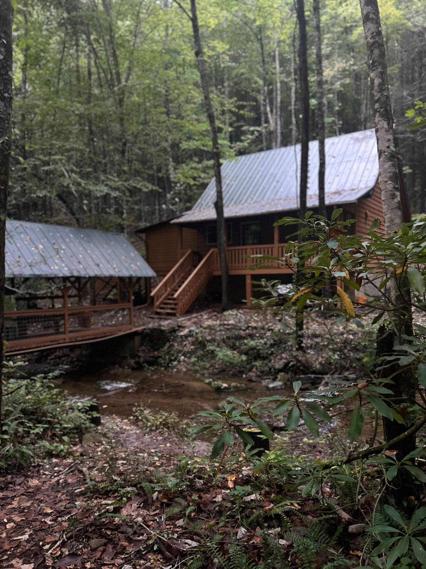
The drive in from Atlanta or Chattanooga is long enough that most people are better off sleeping near the gate than starting at 4 a.m. Sherpa Camp is a small cabin on Holly Creek, on the western edge of the Cohutta Wilderness, about 25 minutes from Ellijay. It sleeps five, with a covered porch, a firepit, and a creek. Cell service ends before you get there.
See Sherpa Camp