Big Frog Mountain
The high point of the Cohutta country, just across the Tennessee line.
At a glance
- Summit
- 4,224 feet
- Location
- Big Frog Wilderness, Cherokee National Forest, Tennessee
- From Georgia
- Benton MacKaye Trail from Dally Gap, 6.8 miles one way
- Shortest climb
- Wolf Ridge Trail, from the Tennessee side
- Best views
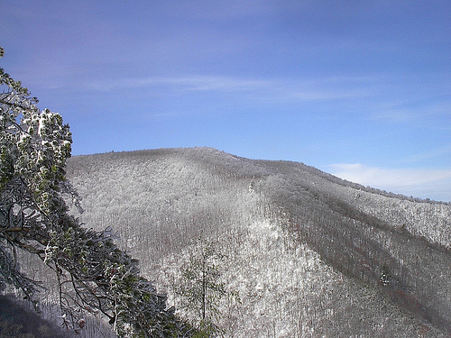
- Winter, through bare trees
Big Frog Mountain is the high point of the Cohutta and Big Frog country at 4,224 feet. The summit sits in Tennessee, in the Big Frog Wilderness, but the mountain spills back across the state line into Georgia.
The top is wooded. In summer you climb through green and see little. In winter the leaves come down and the views open west over the Tennessee Valley and south into Georgia.
Water off this mountain runs toward the Ocoee River, a different river system than the Coosa basin the rest of the Cohuttas feed.
Ways in
From Georgia
- Listed distance
- 6.8 mi one way
- Crossings
- No crossings recorded
- Difficulty
- Strenuous
The direct route from Georgia. Steep and sustained, about 3,660 feet of climbing.
- Listed distance
- 10.6 mi round trip
- Crossings
- No crossings recorded
- Difficulty
- Strenuous
Dally Gap north to Double Spring Gap on the state line, where Hemp Top Trail continues into Tennessee.
- Listed distance
- 5 mi one way
- Crossings
- No crossings recorded
- Difficulty
- Moderate
The Tennessee half of Hemp Top, from the state line toward the summit.
From Tennessee
- Listed distance
- 2.7 mi one way
- Crossings
- No crossings recorded
- Difficulty
- Strenuous
The shortest and steepest way up. Continue past the trail's end on Grassy Gap or Big Frog Trail to reach the summit, about 2,500 feet of climbing in all.
- Listed distance
- 5.5 mi one way
- Crossings
- No crossings recorded
- Difficulty
- Strenuous
The central trail of the wilderness, climbing through a rhododendron tunnel toward the summit.
- Listed distance
- 5.9 mi one way
- Crossings
- No crossings recorded
- Difficulty
- Strenuous
The longest and hardest approach, with views of the Ocoee River and North Carolina near the top.
- Listed distance
- 5 mi one way
- Crossings
- No crossings recorded
- Difficulty
- Moderate
A level, narrow traverse across the midslope that links Wolf Ridge with the summit trails.
Connectors:Big Creek Trail, Yellow Stand Lead Trail, Fork Ridge Trail, Rough Creek Trail, West Fork Trail, Benton MacKaye Trail – Big Frog
Two states, one mountain
Most guides treat the Cohutta and Big Frog as one country, and on the ground there is little to tell you when you cross from one into the other. The Benton MacKaye Trail ties them together, running from Dally Gap over Big Frog and on toward the Ocoee.
Horses
Segments connecting Chestnut Mountain Trail and Hemp Top Trail in Tennessee are open to horses as well as hikers, an exception to the foot traffic rule on most trails here.
Questions
How tall is Big Frog Mountain?
4,224 feet. It is the high point of the Cohutta and Big Frog Wilderness.
What is the shortest hike to the top of Big Frog Mountain?
Wolf Ridge Trail on the Tennessee side is the shortest and steepest. From Georgia, the Benton MacKaye Trail climbs about 6.8 miles from Dally Gap.
Is Big Frog Mountain in Georgia or Tennessee?
The summit is in Tennessee. Part of the mountain extends back across the state line into Georgia.
Are there views from the summit?
The summit is wooded. The best views come in winter, when the leaves are down.
Related
Stay near the trailheads
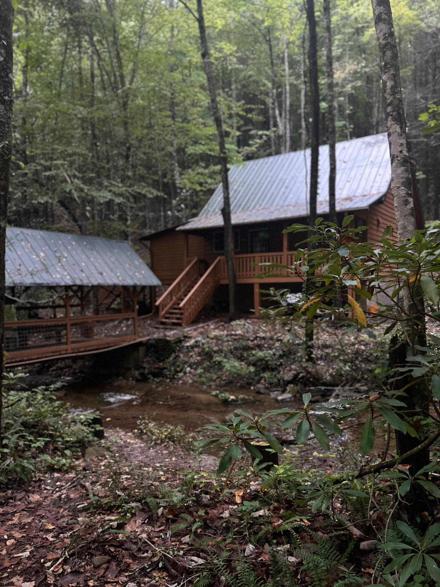
Sherpa Camp — a cabin at the edge of the wilderness.
The drive in from Atlanta or Chattanooga is long enough that most people are better off sleeping near the gate than starting at 4 a.m. Sherpa Camp is a small cabin on Holly Creek, on the western edge of the Cohutta Wilderness, about 25 minutes from Ellijay. It sleeps five, with a covered porch, a firepit, and a creek. Cell service ends before you get there.
See Sherpa Camp